The territory
June 6, 2008
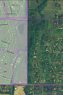
I lost myself for two hours yesterday, though I knew where I was at all times. In fact, it would be difficult to actually lose one’s way along Sourdough Trail. Within the area I frequent, which extends a little beyond the section known as Gardner Park, there’s only one side trail to speak of (deer trails abound, however, and are especially handy when the main path is under water). I was surprised at just how small my patch appears in a satellite view:

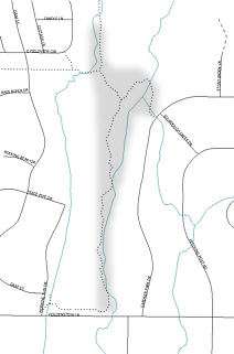
Since you can’t see the trails or even the stream from above, I’ve added a simplified map that shows my project area in gray. Finally, as graphical pièce de résistance, the same Gallatin County mapping service allows one to display the various legal and administrative features not necessarily visible on the ground. I’m beginning to wonder why I don’t feel claustrophobic out there! But the fact of the matter is that, thanks to the water provided by the creek, the vegetation is dense enough that one is seldom aware of anything outside the woods. For better or worse, my attention is almost entirely directed inward.
Filed in: Musings.
